
SERVICES


A LiDAR drone survey uses an Unmanned Aerial Vehicle (UAV) fitted with a survey-grade LiDAR sensor to capture dense, highly accurate 3D point cloud data across large areas, faster and more safely than traditional ground based methods. UAV LiDAR combines aerial mobility with laser scanning precision, making it one of the most effective tools available for topographic surveys, terrain mapping, stockpile measurement, and infrastructure inspection in Australia.
At Precise Spatial, we deploy the latest UAV LiDAR and ground based scanning technology to deliver rich spatial datasets across civil, mining, energy, and infrastructure projects nationwide. Our comprehensive LiDAR and UAV scanning capability means your project gets the data it needs captured efficiently, processed accurately, and delivered in the formats that matter.
LiDAR - Scanning & UAV Capability Statement
What Is a LiDAR Drone Survey?
LiDAR (Light Detection and Ranging) is a remote sensing technology that uses pulsed laser light to measure distances and generate precise 3D representations of the surveyed environment. When mounted on a UAV (drone), LiDAR becomes a powerful aerial surveying tool capable of capturing millions of measurement points per second across large, complex, or hard to access terrain.
Unlike photogrammetry, which relies on visible light photography, UAV LiDAR penetrates vegetation canopy, performs accurately in low light conditions, and delivers survey-grade positional accuracy without relying on image texture. The result is a detailed, georeferenced point cloud that can be used for a wide range of analysis, modelling, and drafting tasks.
Key applications of LiDAR drone surveys include:
-
Topographic survey and terrain modelling over large or complex areas
-
Stockpile volume measurement and cut and fill calculations
-
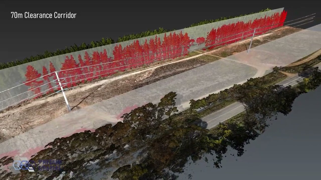
Corridor mapping for roads, rail, pipelines, and transmission lines
-
Vegetation and canopy analysis
-
Flood modelling and drainage design
-
Infrastructure inspection and as-built capture
-
Mining site monitoring and progress surveys

Our LiDAR & UAV Scanning Services
Precise Spatial offers a full suite of LiDAR scanning and UAV survey services, from aerial mapping to underground scanning. Our multi-platform capability means we can select the right method, or combination of methods for your specific project requirements.
UAV LiDAR - Aerial Mapping & Topographic Surveys
Our UAV LiDAR service uses survey grade drone mounted scanners, including the Emesent Hovermap ST-X and CHCNAV AlphaAir 450 on the DJI Matrice 350 RTK platform, to capture high density point cloud data from the air. This aerial surveying approach is ideal for large scale topographic surveys, lidar terrain mapping, stockpile surveys, corridor mapping, and any project where ground access is restricted, hazardous, or time prohibitive.
All UAV LiDAR flights are conducted by experienced operators in accordance with CASA regulations, with ground control established to ensure survey grade accuracy throughout.
Terrestrial Laser Scanning (TLS)
Terrestrial Laser Scanning uses ground based LiDAR instruments to capture highly detailed 3D data of structures, plants, buildings, and confined environments. Precise Spatial operates the Leica ScanStation P40, one of the industry's most capable TLS instruments delivering the highest quality 3D point cloud data along with High Dynamic Range (HDR) imaging. TLS is the preferred method for building scans, industrial plant documentation, structural as-builts, and heritage recording.
Mobile LiDAR Scanning (MLS)
Mobile LiDAR Scanning mounts scanning equipment on a vehicle to capture continuous 3D data along a driven route. This method is highly efficient for road corridor surveys, intersection mapping, underground tunnel mapping, and large facility walkthroughs. Precise Spatial's vehicle-mounted Emesent Hovermap ST-X enables rapid data capture in environments where static scanning or aerial methods are impractical.
Underground LiDAR Scanning
Underground environments present unique challenges for spatial data capture, confined spaces, no GNSS signal, and complex 3D geometry. Precise Spatial's Emesent Hovermap ST-X, with its SLAM (Simultaneous Localisation and Mapping) capability, is purpose built for underground scanning in mine tunnels, drives, and voids. The result is a detailed, navigable 3D model of underground workings aligned with the existing positioning infrastructure.
Why Choose Precise Spatial?
Multi-platform capability
Survey grade accuracy
One provider across UAV, terrestrial, mobile, and underground LiDAR, no need to engage separate specialists for each method.
All aerial and scanning operations are conducted to survey grade standards, with ground control networks established to verify accuracy.
Nationwide FIFO capability
Interactive data delivery
We operate across all Australian states and territories, including remote and regional project sites via FIFO and DIDO arrangements.
Clients receive access to their point cloud data through the Pointerra platform, enabling online viewing, measurement, and sharing without specialist software.
CASA-compliant UAV operations
Our drone operations are conducted in full compliance with CASA regulations by experienced, licensed operators.
Integrated with full survey scope
LiDAR and UAV data integrates seamlessly with our engineering survey, BIM, and monitoring services for a complete spatial solution.
Industries We Serve
Our LiDAR drone survey and UAV scanning services support a wide range of industries across Australia, including:
-
Mining & Resources - stockpile measurement, underground scanning, pit mapping, and FIFO project support
-
Civil Construction - topographic surveys, earthworks volume calculations, and corridor mapping
-
Renewable Energy - solar farm layout surveys, wind turbine corridor mapping, and transmission line as-builts
-
Rail track corridor surveys, infrastructure inspection, and tunnel scanning
-
Roads & Highways - road corridor mapping, intersection scans, and pavement condition surveys
-
Building & Construction - structural as-builts, heritage recording, and BIM-ready point cloud capture
-
Utilities & Infrastructure - pipeline corridors, substation documentation, and underground utility mapping
Our Equipment & Technology
Precise Spatial invests in leading-edge LiDAR and UAV technology to ensure our clients receive the highest quality spatial data. Our current fleet includes:
-
Emesent Hovermap ST-X: handheld, drone and vehicle mounted SLAM LiDAR scanner, capable of UAV aerial surveying, vehicle mounted mobile scanning, and autonomous underground mapping
-
DJI Matrice 350 RTK: professional survey grade UAV platform providing stable, precise aerial operations across a wide range of conditions
-
Leica ScanStation P40: industry leading terrestrial laser scanner delivering ultra-high quality 3D point cloud data with HDR imaging
-
CHCNAV Alpha Air 450: integrated aerial system combining high-resolution camera and LiDAR sensor for accurate 3D scanning with full-colour point cloud documentation. Ideal for detailed mapping, visualisation, and model generation.
-
DJI H20T: versatile drone camera system with super-zoom optical cameras, thermal imaging, and accurate ranging capabilities. Supports infrastructure inspection with high-quality imaging.
-
Pointerra 3D platform: cloud based point cloud viewer and analysis platform - we provide clients with interactive access to their LiDAR datasets online

LiDAR vs Photogrammetry - Which Is Right for Your Project?
Both LiDAR and photogrammetry are scanning survey technologies, but they suit different project conditions. Here's a straightforward comparison to help guide your decision:
-
Vegetation & canopy: LiDAR penetrates tree canopy to capture ground surface beneath, photogrammetry cannot.
-
Accuracy: UAV LiDAR typically delivers higher absolute positional accuracy for survey grade applications.
-
Low-light & shadow conditions: LiDAR performs in low-light; photogrammetry depends on consistent lighting and image quality.
-
Texture & colour: Photogrammetry produces coloured, textured 3D models - LiDAR point clouds require colouring from imagery if needed.
-
Cost: Photogrammetry can be more cost effective for open terrain with good lighting; LiDAR is preferred where precision and penetration matter.
-
Speed over large areas: Both methods are efficient at scale, but LiDAR is generally preferred for complex terrain and mining environments.

EXAMPLE LIDAR DATASET
Precise Spatial provides clients and prospective partners with access to example LiDAR datasets through the Pointerra platform. These interactive point cloud examples demonstrate the quality and detail of data our scanning services produce across a range of environments and applications. Example datasets available to explore online include:


LiDAR - Scanning & UAV
Precise Spatial: Leica P40
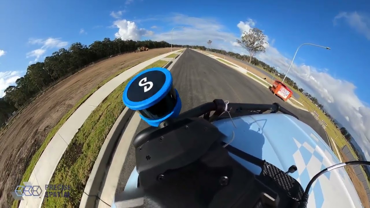
Precise Spatial: Emesent Hovermap ST-X - Vehicle
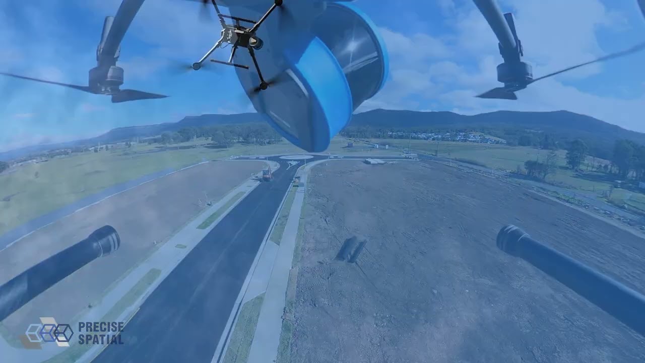
Precise Spatial: Emesent Hovermap ST-X - Drone
FREQUENTLY ASKED QUESTIONS (FAQs)
What is a LiDAR drone survey used for?
A LiDAR drone survey is used to capture detailed, survey-grade 3D spatial data across large or complex areas from the air. Common applications include topographic mapping, stockpile volume calculations, corridor surveys for roads and pipelines, mine site progress surveys, and infrastructure inspection. UAV LiDAR is particularly valuable where ground access is restricted, terrain is complex, or traditional survey methods would be inefficient.
How accurate is UAV LiDAR?
Survey grade UAV LiDAR systems, like the Emesent Hovermap ST-X, can achieve absolute positional accuracies of 30-50mm in open conditions with appropriate ground control. With a well designed ground control network, accuracies of 20mm or better are achievable for many applications. Accuracy depends on platform stability, flight altitude, ground control configuration, and site conditions.
What is the difference between LiDAR and photogrammetry?
LiDAR uses laser pulses to directly measure distances and generate a 3D point cloud, while photogrammetry reconstructs 3D geometry from overlapping photographs using image matching algorithms. LiDAR performs better in dense vegetation, low light conditions, and where survey grade accuracy is required. Photogrammetry produces coloured, textured models and can be more cost effective for open terrain in good lighting conditions.
Can you conduct UAV surveys on remote or restricted sites?
Yes. Precise Spatial operates FIFO and DIDO across Australia, including remote mining and infrastructure sites. All UAV operations are conducted in compliance with CASA regulations, and our team is experienced in working within site safety management plans and remote work protocols. We can obtain necessary CASA approvals for operations in controlled or restricted airspace where required.
What file formats are LiDAR deliverables provided in?
LiDAR point cloud data is typically delivered in LAS or LAZ format, compatible with all major point cloud processing and CAD platforms. We can also provide processed deliverables including Digital Terrain Models (DTMs), Digital Elevation Models (DEMs), contour data in DWG or DXF format, and volume reports. Clients also receive access to their data through the Pointerra online platform for browser based viewing and analysis.
Do you offer underground LiDAR scanning?
Yes. Precise Spatial's Emesent Hovermap ST-X uses SLAM technology to map underground environments without requiring GNSS positioning. This makes it ideal for underground mine drives, tunnels, and confined spaces where traditional survey methods are slow, hazardous, or impractical. Data is delivered as a fully georeferenced 3D point cloud.

GET IN TOUCH
Ready to Get Started? Do you offer underground LiDAR scanning?
Contact Precise Spatial today to discuss your LiDAR drone survey or UAV scanning requirements. Our team operates across Australia and is ready to support your next project.
JOIN THE TEAM
Visit the Careers Page, and see all current opportunities.
If there is no listing for an opportunity you are interested in, contact us with your information and resume to be considered for a future position with us.